LOYALIST PARKWAY

Loyalist Parkway Map - TAP HERE

Loyalist Parkway Virtual Tour - opens in a new window

In 1984, Queen Elizabeth commemorated Highway 33 between Trenton and Kingston as the Loyalist Parkway at a ceremony in Amherstview in honour of the United Empire Loyalist settlers that landed there in 1784.

Highway 33, known since 1984 as the Loyalist Parkway, follows a pioneer colonial route on which the first segments were built two hundred years prior. The route connects several historical settlement sites in Prince Edward County, continuing east through Bath to what is now Kingston.

Highway 33, known as the Loyalist Parkway throughout its length, begins in the west at the southern terminus of Highway 62, west of which the parkway continues as Prince Edward County Road 33 to Trenton. The route begins at Highway 62 in Bloomfield and travels east to the Collins Bay Road junction at Collins Bay in the city of Kingston, a distance of 60.9 kilometres (37.8 mi). The Glenora Ferry Service crosses between the two sections just east of Picton, transporting vehicles and pedestrians for free throughout the year.

To the east of Bloomfield the Parkway crosses several creeks and then intersects Prince Edward County Road 1 at the first modern provincially maintained roundabout. East of this, the highway enters into the city of Picton. Within Picton, Highway 33 intersects the former Highway 49, now Prince Edward County Road 49. It exits the city and follows the southeastern shoreline of Picton Bay. Highway 33 has two sections, which are joined by the Glenora Ferry, an auto ferry crossing the Bay of Quinte from Glenora to Adolphustown. The eastern section of the highway begins west of Adolphustown, where it passes by several Loyalist heritage sites. Now in the county of Lennox and Addington, the route remains close to the shores of the Bay of Quinte for the remainder of its journey towards Kingston. The short section of Highway 33 within Kingston travels as far east as Collins Bay Road, in the community of Collins Bay. From this point, the road continues east as Bath Road (Kingston City Road 33), ending at Princess Street, formerly Highway 2.

The Loyalist Parkway Association can be reached at:
P.O. Box 381,
Bloomfield, ON
K0K 1G0
Phone: 613-399-5490
e-mail: secretarialhilary@hotmail.com
Printed Guide Maps of the Loyalist Parkway are available from this office or from most tourist services in the region.

Kilomarkers have been installed every 5 kms along the 100 km route.

A one-metre wide bicycle path accompanies much of the Loyalist Parkway.


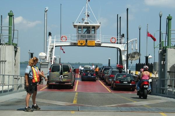
Glenora-Adolphustown Ferry service
Winter (mid-October to Victoria Day weekend)
Daily 30-minute service 6 a.m. to 1:15 a.m.
Spring (Victoria Day weekend to late June)
Mon-Fri: 30-minute service 6 a.m. to 1:15 a.m. Weekends and Victoria Day only: 30-minute service 6 a.m. to 10 a.m. 15-minute service 10:15 a.m. to 7:30 p.m. 30-minute service 7:30 p.m. to 1:15 a.m.
Summer (Late June to mid-October)
30-minute service 6 a.m. to 10 a.m. 15-minute service 10:15 a.m. to 7:30 p.m. 30-minute service 7:30 p.m. to 1:15 a.m.

Loyalist Parkway, Highway 33, just west of Picton, became the site of the first roundabout on a provincial highway.


Trenton Ontario is a Year Round Destination:
Spring, Summer, Fall and Winter
There's always something exciting to
See, Do, Discover, Explore, Enjoy and Experience!!


Trenton Gas Prices


© Copyright 2001-   All Rights Reserved

Top of Page.